


Madrid Subway Off-Line
คำอธิบายของMadrid Subway Off-Line
The application is intended for quick and easy calculation of routes between two Madrid Subway stations without internet connection.
We will also have the chance to see the itinerary to make and its details. We can find the nearby stations to our position and, using Google Maps, guide us to them.
In future updates can save favorite routes, see google maps and viewing stations itineraries in the subway map and more...
Included:
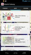
- New maps of Madrid subway 2013.
- All stations on Off-Line mode.
- Fast location and easy route calculation.
- Complete itinerary information, duration of journey and transfers to be performed.
</div> <div jsname="WJz9Hc" style="display:none">โปรแกรมมีไว้สำหรับการคำนวณที่ง่ายและรวดเร็วของเส้นทางระหว่างสองสถานีรถไฟใต้ดินมาดริดโดยไม่ต้องเชื่อมต่ออินเทอร์เน็ต
นอกจากนี้เรายังจะมีโอกาสที่จะเห็นการเดินทางที่จะทำให้การและรายละเอียดของ เราสามารถหาสถานีที่ใกล้เคียงกับตำแหน่งและของเราโดยใช้ Google แผนที่แนะนำเราให้กับพวกเขา
ในการปรับปรุงในอนาคตสามารถบันทึกเส้นทางที่ชื่นชอบดู Google Maps และเส้นทางที่สถานีดูในแผนที่รถไฟใต้ดินและอื่น ๆ ...
ที่มีให้:
- แผนที่ใหม่ของรถไฟใต้ดินมาดริด 2013
- ทุกสถานีโหมดปิด-Line
- สถานที่ได้อย่างรวดเร็วและการคำนวณเส้นทางที่ง่าย
- ข้อมูลการเดินทางที่สมบูรณ์ระยะเวลาของการเดินทางและการโอนที่จะดำเนินการ</div> <div class="show-more-end">
Madrid Subway Off-Line--เวอร์ชั่น2.2
(02-03-2014)Madrid Subway Off-Line - ข้อมูล APK
เวอร์ชั่น APK: 2.2แพ็คเกจ: com.djardon.MadridSubwayเวอร์ชั่นล่าสุดของMadrid Subway Off-Line


แอปในประเภทเดียวกัน

คุณอาจจะชอบ...


